SargaDB

SargaDB

Sargassum data for the Riviera Maya

An Open Sargassum Data Aggregator

SargaDB is an open, non-profit effort to consolidate scattered sargassum data — official readings, satellite imagery, and real visitor reports — into one honest, historical, freely queryable source.

View live map
Data from
  • Red de Monitoreo del Sargazo
  • LANOT/UNAM
  • NOAA
  • USF
  • CONABIO

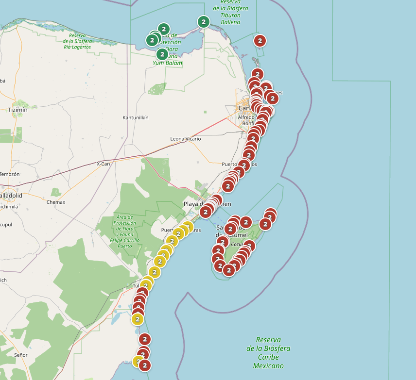
Live conditions for one beach — click to see the full map

Preview of the live sargassum conditions map

Live map — click to explore

By the numbers

Wind & Wave Estimate Official Readings Visitor Reports Satellite Detection & Forecasts SargaDB Historical, open, and queryable Wind & Wave Estimate Official Readings Visitor Reports Satellite Detection & Forecasts SargaDB Historical, open, and queryable

Data Sources

Wind & Wave Estimate

Official reading — Red de Monitoreo del Sargazo

Recent reports from visitors

Official satellite detection — LANOT/UNAM

Regional outlook — USF Sargassum Watch System

Sargassum Presence Risk — NOAA/USF SIR

Sargassum Arrival Forecast — CONABIO SATsum-Drift

Frequently Asked Questions

What is SargaDB?

Is this official? Who runs it?

How often is the data updated?

What do the colors mean?

Why do the estimate and the official reading sometimes disagree?

Can I see past dates?

How do I contribute a report?

Is there an API?

Is it free?

Why are there so many different indicators?

Open Data — Coming Soon

Mobile app — to be announced

Tell us more (optional)